
Photo by Tom Fisk on Pexels
When Typhoon Isang (Olga) hit Antipolo, Rizal on the night of August 3, 1999, the residents of Cherry Hills Subdivision had no idea that they’d be contending with more than just heavy rains. The low-cost houses in the subdivision were located on a steep slope—a clear natural disaster waiting to happen. Quarrying in the nearby mountain further compromised the stability of the site. The drainage system was also insufficient, resulting in soil that became too loose and wet to support buildings.
Down came the rain; so did the ground. The tragic incident resulted in the deaths of 58 people, with 378 houses buried. Investigations later showed that the tragedy could have been prevented had the developer conducted proper geological survey to determine if the site was safe for development to begin with.
Today, real estate developers have the tools that can improve site analysis, planning accuracy, and construction monitoring. Drones, for instance, when used with Geographic Information System (GIS), can offer crucial insights in all stages of property development. Here are common problems developers encounter at each stage, and how drones for real estate can offer preventive solutions.
Pre-construction
Problem: Poor site selection, overlooked land limitations, and costly design revisions
Using outdated maps, incomplete data, and limited ground surveys when evaluating land for development can lead to poorly selected sites and inaccurate information on land limitations. This can then result in major design revisions or, worse, disasters like the Cherry Hills Subdivision tragedy. There are a host of other factors that led to the tragedy, and among them is the basic responsibility to make sure that the site is suitable for development.
Solution: Accurate assessment using drones for site selection
For better site assessment, it’s best to rely on highly detailed maps that provide information on the elevation of the land and other significant characteristics of the terrain that can affect development and construction. These maps can be produced using aerial images captured by drones. These images, when used with GIS, allow developers to:
· Better evaluate the terrain and elevation of the land
· Identify drainage patterns and flood-prone areas
· Accurately map out site dimensions and boundaries of the property
· Save on time and costs versus traditional land survey methods
Problem: The development is not well-adapted to the surrounding landscape
When the development is not suited to the area it’s constructed in, several issues could arise: frequent flooding, structural risks, and inefficient access routes, to name a few. These make the property unattractive to prospective buyers.
Solution: 3D modeling and master planning
By using drone images processed into detailed 3D models of the development site, planners and architects can readily see how the property will fit the landscape. 3D models and digital twins can be used to simulate sunlight exposure, shadows, and the impact of a building’s height to help designers plan better.
Efficient master planning using 3D technology also allows for proper zoning and urban planning analysis. Enhancements on development layouts can also be done on time before actual construction commences.
Problem: Costly redesigns due to poor infrastructure planning
Having little or inaccurate detailed information on the terrain often leads to poorly planned infrastructure such as drainage systems, water supply, sewage, roads, and power lines. The consequence? Redesigns that cost a lot.
Solution: Drone-generated site maps
Infrastructure planning can benefit from drone-generated site maps to help planners better design green spaces, road networks, utility lines, and drainage systems. To determine the best location of the infrastructure, developers can also take advantage of GIS for spatial analysis.

Photo by Kelly on Pexels
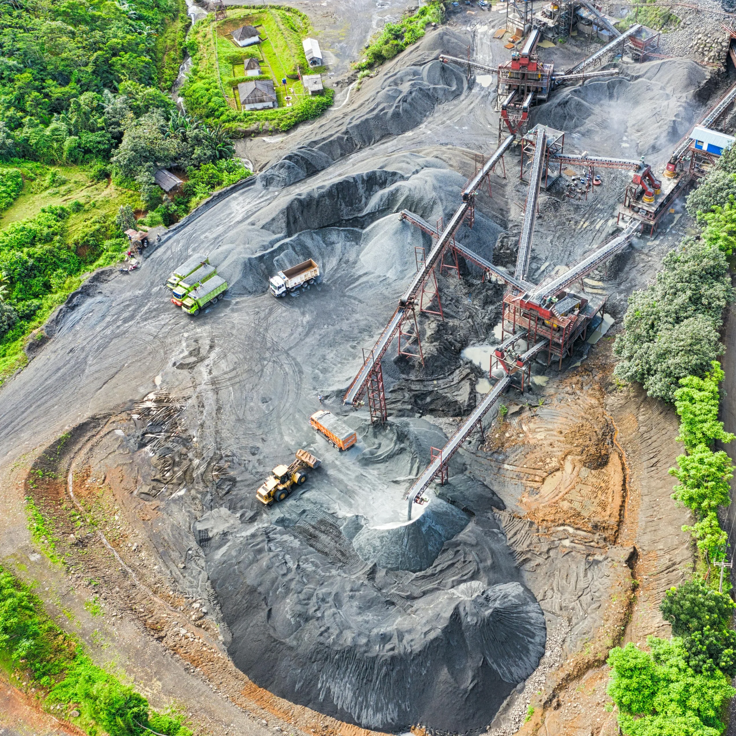
During construction
Problem: Coordination issues and delays
Without regular monitoring of the construction site, the development is bound to encounter delays, problems with coordination, and discrepancies between plans and the actual site condition. This is especially true for large construction sites because they’re more challenging to monitor with just ground inspections.
Solution: Using drones for construction monitoring
Regular aerial inspections using drones can paint a better, more accurate picture of the construction progress across the entire site. Because drones can collect data faster than inspections done on foot, it’s easier to check project plans against the actual development.
Developers can quickly resolve delays and errors as soon as they are identified. Project managers, investors, and stakeholders can also be provided with progress reports on time.
The developers of The Crossings, a mixed-use development in Burlington, New Jersey in the U.S., used drones to survey the massive property. At about 97 hectares, the site was a challenge to survey on foot.
Coupled with LiDAR, a technology that uses laser light to measure distances and render detailed 3D maps, drone data revealed a missing 76,000 cubic meters of soil, which had already been delivered even before the cut-and-fill balance began. Initial ground measurements overlooked the missing dirt as the land surrounding it got higher. Had this not been detected, the project would have been delayed—a costly consequence that was promptly avoided.
Post-construction
Problem: Slower sales
With traditional photography, it can be challenging to showcase the full scale, layout, and value of a property, including its surrounding landscape. This can affect how potential buyers perceive the property’s value, leading to disappointing sales.
Solution: Engaging promotion
Aerial photos, coupled with beautiful interior styling and photography, give potential buyers a better idea on the property they’re interested in. Cinematic fly-throughs provide a visual context on the location of the property and its nearby amenities, like parks and commercial areas. Views from a higher vantage point also lend a grand impression that buyers find attractive.

Photo by Shalom De Leon on Pexels
Problem: Limited visibility into building conditions
Maintaining a building’s structural integrity is especially challenging and risky using traditional inspections. Hard-to-reach areas, such as rooftops, utilities, and drainage systems and gutters that are spread across the development, can be difficult to oversee.
Improper maintenance can lead to safety hazards, leaks and flooding due to undetected drainage issues, and overall inconvenience. These, in turn, lower the residents’ quality of life.
Solution: Drone inspection
Drones can be used to capture detailed photos of rooftops and hard-to-reach infrastructure for regular inspections to prevent or rectify damages. Using these aerial tools shifts the process from reactive maintenance to something that’s preventive and, in the long run, cost-effective.
A commercial building in Australia, for instance, used drones to thoroughly inspect the façade of five high-rise buildings. The inspection took less than two days. If it were done manually by workers who use rope to scale the structure, inspection would have taken 12 to 14 days; it would have been risky, too.
Problem: Environmental damage and unstable site
Real estate developers must comply with environmental regulations, like securing an Environmental Compliance Certificate (ECC) from the Department of Environment and Natural Resources (DENR). The ECC ensures that the development adheres to the environmental laws and will not have any significant negative impact on the environment. Local government units (LGUs) also require developers to comply with zoning laws and land use plans. Failure to do so can result in fines or project cancellation.
Solution: Regular environmental monitoring
It’s now easy to regularly monitor environmental conditions, thanks to drones and GIS. Aerial imagery and data analysis provide information on vegetation loss, soil erosion, and changes in land use.
The environmental impact of real estate developments doesn’t stop once the last building has been erected. Hence, constant monitoring is crucial to identify any emerging issues and rectify these as soon as possible. Failure to immediately identify potential problems, like unstable slope or damaged drainage system, can be costly and may contribute in accelerating the decline of a property’s value.
Developers can take advantage of the benefits of drones for real estate development to make sure the project is done in the safest and most efficient way possible—from the planning stage to post-construction.
If you want to explore how you can maximize the use of drones and GIS in property development, do message us. We’d be glad to sit down with you.