How Has Baguio City Changed Over the Last 30 Years?

As it continues to embrace development and tourism, the City of Pines undergoes a drastic change

Photo by Pushpins

There is no doubt that Baguio City is a top-of-mind destination as soon as the hot season kicks in. In fact, just last year, the city touted as the Summer Capital of the Philippines saw a 15.7 percent (that’s about 1.8 million visitors ) increase in tourist arrivals compared with the numbers in 2017.

Baguio has continued to attract hordes of tourists especially during the summer months and Christmas season. Its popularity can be attributed to the cool weather and the Panagbenga Festival, plus the growing number of food establishments that have been popping up in the recent years, And since the construction of the Tarlac-Pangasinan-La Union Expressway (TPLEX), the city has also become an accessible weekend destination all year round.

The influx of tourists undoubtedly created more job opportunities for the locals, further spurring the development of the city. Unfortunately, all this has taken a toll on the city itself. In recent years, a number of issues has plagued Baguio: waste management disposalworsening traffic situation, and depleting natural resources. In a span of 30 years, the once bucolic destination has seen drastic changes.

Man vs. nature

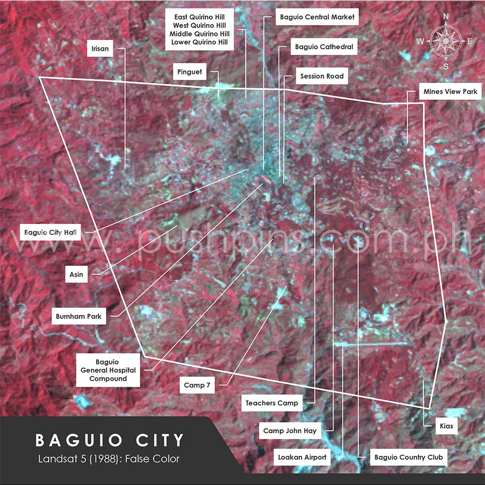
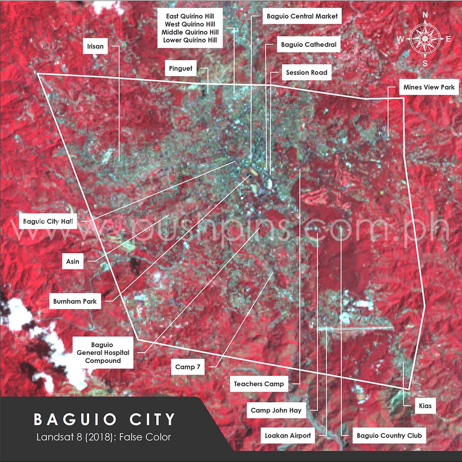
The following figures illustrate how the city looks then and now, and how Baguio has changed within the last three decades as urban development gradually encroach on natural terrain. Also shown are the derived built-up or developed areas generated from their Normalized Difference Built-up Indices (NDBI) and Normalized Difference Vegetation Indices (NDVI). Please note that these data are based on our interpretation of the satellite imageries. No verification on the ground was conducted.

2018

1988

In 1988, developed areas covered only about eight percent of Baguio. These were generally scattered all throughout the city. A big chunk was located downtown (i.e., Session Road, the City Market, the City Hall, the Baguio Cathedral, and all developments around Burnham Park). A relatively high density of built-up areas likewise occupied the surroundings of the Loakan Airport and the barangays of Pinguet and the Quirino Hills (East, West, Middle, and Lower).
 
Paving paradise

Fast forward to 30 years, and the developments have grown by more than double, particularly in the northern part of the city. Existing urban districts that stem from downtown Baguio have become denser and are encroaching on open spaces. Furthermore, small patches of built-up areas, such as those located in the northwestern part of the city, have mushroomed. Burnham Park, which used to be hemmed in only in its northern side, is now surrounded by various structures.

Outgoing Mayor Mauricio Domogan recently suggested to exempt Baguio  from Presidential Decree 705, which states that “no land of the public domain eighteen percent (18%) in slope or over shall be classified as alienable and disposable.” This means that forested areas, which are considered public domain, cannot be utilized for developments, commercial or otherwise. However, even before Domogan’s request, the said presidential decree had already been revised to give more leeway to lands that have been used for agricultural and residential purposes provided certain parameters were met. This is, in part, due to the city’s terrain. Hence, completely exempting Baguio from the decree, as Domogan suggested, will open the city to further developments.

The figures below show the slope maps of Baguio derived from the Shuttle Radar Topography Mission (SRTM) Version 3.0 Global 1 arc second data. While both may look similar, the second map has been further simplified to better illustrate which regions are less than 18% in slope and which are equal to or above the threshold value.

SlopeMap1_20190619
SlopeMap2_20190619

Overlaying these maps with the 2018 built-up area data reveals that structures have been erected on these otherwise restricted lands, as evident in the map below. Whether the legal requirements have been met is still in question.

SlopeMap2BU2018_20190619

Meanwhile, the map below shows the remaining patches of undeveloped land with slopes that are less than 18%. This makes up about 25% of the city’s land area, and includes prominent tourist sites like Camp John Hay and Baguio Country Club. Exploiting these would mean further depletion of the city’s land resources.

SlopeMap2PotentialSites_20190619

Baguio’s charm lies in its natural attractions—the cool clime, idyllic surroundings, and towering pine trees. If Baguio City hopes to remain as the Summer Capital of the Philippines, it must find a way to urgently promote sustainable tourism and development.

The images presented above were generated from Landsat 5 and 8  satellite imageries courtesy of the U.S. Geological Survey.

All information presented here are based on limited data available and are only meant for an overview of the subject. For in-depth analyses, an extensive study is necessary.

Pushpins is a GIS company based in the Philippines. For more information, log on here

Related Posts